Dogs Leashed

E-Bikes
Not Allowed

No closure dates. Opt out of the river crossing into McKeldin during cooler weather because your feet will get wet and cold and stay wet and cold.
Overview
This is it, the legendary Tour de Patapsco, a 50+ mile Avalon to McKeldin adventure ride featuring the best of the beautiful Patapsco Valley State Park and surrounding areas. Be prepared for steep climbs, fast descents, gnarly rock gardens, hike-a-bike, a little bit of road riding, and a hike across the river.
The TdP is a challenging ride for experienced intermediate and advanced riders, testing the technical skills and endurance of even the most accomplished rider. Although at all times you'll be within minutes of suburban Baltimore/DC, you'll feel like you're on a remote backcountry adventure.
This ride is not for the faint of heart: the numerous short but steep climbs will wear you down and send you to bonktown if you're not attentive to your hydration and nutritional needs. Bring the GPS track, a printed map, nutrition, and anything required in case of mechanicals. Plan for 7-10 hours of riding depending on pace and amount of stopping. Consider a rehydration plan before embarking, using the convenience stores and/or park facilities along the route, or dropping water ahead of time.
The TdP was originally conceived by local mountain bikers out to link the Avalon/Orange Grove area of Patapsco to the McKeldin area using as much trail as possible. Way back when, the route was not only very challenging but also notoriously difficult to navigate, featuring plenty of unmaintained trails, some bushwhacking, and plenty of surprises along the way. Today, through the considerable efforts of MORE, in cooperation with the Park, along with thousands of volunteer hours, installation and improvement of numerous miles of hand-built singletrack have made the TdP easier to navigate and all-in-all more enjoyable than it once was.
This is an epic ride on every area mountain biker's bucket list.
Need to Know
The river crossing into McKeldin can be up to 2 feet deep following periods of heavy precipitation, but typically you can ride across. Water will be cold in the winter months and will surely get into your shoes, so you may want to opt out of this portion of the route when it's cold
An intermediate to advanced rider will finish the route in 7-10 hours so plan accordingly. The numerous short but steep climbs will wear you down. Bring adequate water, nutrition, repair supplies. While there are some convenience stores and park facilities along the way, you may consider dropping water/food at Old Frederick Road by the green metal bridge (you'll cross by at miles 14 and 38) and/or the end of the Old Court Road access road (miles 21 and 30). Note that the water inside the park is shut off during the winter season - if in doubt, contact the park.
Most of the trails are poorly marked. BRING GPS AND PRINTED MAP. Cell coverage may be poor in some areas. The
MTB Project mobile app is recommended.
Description
You'll start and end at a trailhead near CCBC Lot 6 parking area. The
College Loop trail will take you to the
Santee Branch Trail which becomes the
Saw Mill Trail. Cross Hilltop Rd to begin the
Gray's Mill Trail which takes you across Thistle Rd before eventually dumping you onto Frederick Rd.
The Cycle Mill bike shop is on the corner of River and Frederick. Make a left onto busy Frederick Rd, cruise downhill to a shared private driveway with a right-of-way to an access road/trail to Banneker Park. Climb up into Banneker. Follow the
Outer Loop Trail around to cross Bryans Mill Way and continue on singletrack down to the
Trolley Trail, a popular paved trail that climbs up to Oella Ave. At Oella and Westchester Ave there is a convenience store, a good place to refuel as the next water stop is 15 miles away.
Climb Westchester to Rest to Rockhaven Ave, which leads you to a trailhead on your left across the street from a ball field. The singletrack will descend to the
Oella Mill Race Trail, which you'll follow to a crossing underneath Rt 40. Proceed under the bridge then immediately make a right to begin the technical "Devil's Horns" section of the Pickall area.
Eventually, you cross the stinky Cedar Branch, then ride ridgeline singletrack eventually to the flowy Dogwood trail, which crosses a Park road then Johnnycake Rd (be careful crossing!) before ending on Dogwood Rd. Quick left after the bridge through the parking area onto
Alberton Road, an old roadbed closed to traffic. Alberton eventually thins down to singletrack near Daniels Dam and takes you towards active railroad tracks. Follow the trail on the river side to go underneath the RR tracks alongside a creek, cross the creek, and begin the rocky climb on the
Thru Trail.
Follow the
Thru Trail &
Middle Thru Trail all the way to Woodstock/Old Court Rd where you'll cross a creek and make a right to begin a doubletrack climb. Go right at intersection, that takes you up to the old Fox Rock granite quarry. Continue on the
Thru Trail skirting the old Herndon Landfill before a fun descent to the North Branch of the Patapsco River which you'll soon cross into McKeldin at a section that is typically shallow enough to ride.
In McKeldin, follow the
Switchback Trail up to the main parking areas where you'll find facilities and water. Take the
Switchback Trail to the
Plantation Trail, a fun descent that brings you back down to riverside doubletrack before crossing the river back into Woodstock.
Follow the
Thru Trail down-river to the creek crossing that started the loop. Take the access road to Old Court Road, ride the bridge with traffic across the Patapsco, then make a left into the parking area immediately past the RR tracks -- you'll see the trailhead at the downstream end. Follow the
HoCo Thru Trail for several hilly miles. There is riverside doubletrack bailout option until Daniels Rd. Take the
Daniels Access Trail to cross Old Frederick Rd on
Old Ranger Trail into Hollofield, which gets techier.
Hollofield area has facilities and water on the other side of Rt 40. Ride the
OEC Connector to Sylvan Lane to Park to Church down to Main Street (Frederick Rd) through historic Ellicott City (convenience store on your left) to River Rd.
River Rd becomes Illchester when you cross over the Patapsco. Immediately turn left, climb over the guardrail onto the old River Road and look for the start of Bloede Dam Trail on your right. Take Bloede to
Garrett's Pass to
Morning Choice, West to
Connector to
Ridge Trail to
Valley View East, back to
Ridge Trail and down the
Ridge Trail Extension to River Rd. Ride the road around the bend across the river, then
Gunned takes you to the Lost Lake area. Ride the paved Grist Mill trail to
Vineyard Springs trail which takes you under the RR then up a gradual climb to
Santee Branch Trail. Santee takes you to the
College Loop you started on. Climb up to the trailhead and you're done!
History & Background
The Patapsco River Valley is rich with history pre-dating the 1800s. Remnants of the old Grist Mill towns, granite quarries, and farming areas, along with evidence of the damage caused by Hurricane Agnes, can be found trailside. You'll ride through historic Ellicott City, founded 1772. The Patapsco Valley State Park was established in 1907.
For more history of the Park, see the
Patapsco Heritage website.
For some historical perspective on the Tour de Patapsco, details of the original route can be found
here. But note that much has changed since then(!):
Contacts
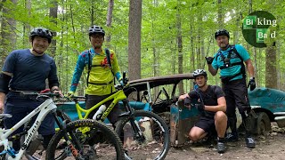
Shared By:
Ken Lohr
with improvements
by John John

 Tour of Lower Patapsco (Avalon, Orange Grove, Glen Artney, and Hilton)

 Ilchester, MD
 Chevy Woodstock Loop
")

 Continue with onX Maps
 Sign in with Facebook


0 Comments