
 Continue with onX Maps
 Continue with Facebook


 Difficult

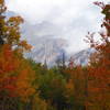
“Much hike-a-bike rewards you with great views at the top (Inspiration Point) and a fun descent. ”


3.6
Miles5.8
KMSingletrack
 Difficult
Local Club: Taos Mountain Bike Association (TMBA)
Feb 10, 2024: 2024 Film Festival : FREE Admission
Oct 3, 2023: Become a TMBA Member, Support Trails and Enter to Win Prizes All at Once!
Jul 23, 2023: Thanks for Standing Up for Trails
Land Manager: USFS - Rio Grande National Forest Office
 FSR 523/524
14.1 mi 22.7 km • 2,085' Up 635.4 m Up • 2,080' Down 633.89 m Down

 Snow Mesa to Miner's Creek
16.7 mi 26.8 km • 1,686' Up 513.99 m Up • 3,550' Down 1082 m Down
 Cataract Ridge Backcountry
38.0 mi 61.2 km • 6,272' Up 1911.84 m Up • 6,619' Down 2017.32 m Down
 Jarosa Mesa Loop
18.6 mi 29.9 km • 2,128' Up 648.58 m Up • 2,105' Down 641.69 m Down
The Alpine Loop
50.9 mi 82.0 km • 6,023' Up 1835.92 m Up • 6,015' Down 1833.29 m Down
Lake City, CO
Colorado Trail: The Entire MTB Route - IMBA EPIC
549.3 mi 884.0 km • 71,117' Up 21676.5 m Up • 69,664' Down 21233.6 m Down
Roxboro…, CO


0 Comments