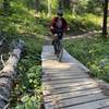
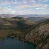
“Climb into the Mountains around McCall. ”
10.5
Miles16.9
KMSingletrack

Local Club: Central Idaho Mountain Bike Association
Land Manager: USFS - Payette National Forest Office
 Blackwell Lake Loop
10.1 mi 16.2 km • 1,775' Up 541.08 m Up • 1,771' Down 539.73 m Down


 McCall, ID
 Idaho Trail Segment 10
44.0 mi 70.7 km • 6,701' Up 2042.45 m Up • 9,812' Down 2990.59 m Down


 Cascade, ID
 Paddy Flat to The Pins to Gold Fork and Back
45.1 mi 72.5 km • 3,279' Up 999.52 m Up • 3,279' Down 999.58 m Down


 McCall, ID
 Bear Basin Tour
12.0 mi 19.3 km • 1,426' Up 434.69 m Up • 1,429' Down 435.68 m Down


 McCall, ID
 Idaho Trail Segment 12
53.4 mi 85.9 km • 7,941' Up 2420.49 m Up • 7,575' Down 2308.95 m Down


 McCall, ID
 A Big Frenchy Pete
47.3 mi 76.2 km • 6,617' Up 2016.93 m Up • 6,517' Down 1986.34 m Down


 McCall, ID


0 Comments