MTB Project Logo

If the conditions are right, this canyon gets you to the Colorado River from the Lockhart Basin road


Your Rating: Rating Rating Rating Rating Rating      Clear Rating
Your Difficulty:
Your Favorites: Add To-Do · Your List
Zoom in to see details
Map Key

5.5

Miles

8.9

KM

Doubletrack

4,201' 1,280 m

High

3,944' 1,202 m

Low

36' 11 m

Up

293' 89 m

Down

1%

Avg Grade (1°)

6%

Max Grade (4°)

Dogs No Dogs

E-Bikes Unknown

Be advised that the road enters Canyonlands National Park near the river, so those stricter use rules apply.

Please Respect and Protect archaeological sites: Stay on trail, help prevent damage. Don't move artifacts, let everyone enjoy the discovery. Stay out of ancient buildings and off walls, they are fragile! Report looting and vandalism: 1 800 722 3998

Description

Lockhart Canyon is just about the only place along the Lockhart Basin road that allows bikers access to the Colorado River shoreline.

You can use this spur to extend your Lockhart Basin ride, or, with pre-arrangements, possibly to meet up with a river trip down to the Confluence, or a jet boat for a quick trip back to Moab. This canyon is also a good candidate for some sort of bike/packraft adventure, possibly exiting via Lathrop Canyon and the White Rim Trail; via Red Lake and Elephant Hill; or even via Spanish Bottom and the Doll's House. You could also exit here after packrafting from Potash.

Since it runs in a large desert wash, expect sand on this route! If you happen to hit the road in good conditions, you'll wonder what all the fuss is about. But if you catch it dry and churned up, you'll likely find it completely unrideable.

Maintenance on this road is sporadic, so your shuttle vehicle may have even more trouble, depending on the recent flood history.

This canyon is high adventure in a very remote place--be sure you are well-equipped and have a plan before heading off glibly down the road! Once at the river, quicksand and thick brush may limit your access to the water.

On the topic of water, it's never a good idea to plan on using the river water as your drinking supply. It's often too silty and will clog any filter unless you settle it overnight. Side canyon water is often minerally and hard to digest even after filtering. Bring all the drinking water you need with you, and some fresh iodine tabs just in case things go pear-shaped.

Contacts

Shared By:

F Felix

Trail Ratings

  2.5 from 2 votes

#34417

Overall
  2.5 from 2 votes
5 Star
0%
4 Star
0%
3 Star
50%
2 Star
50%
1 Star
0%
Trail Rankings

#1,292

in Utah

#34,417

Overall
4 Views Last Month
1,274 Since Dec 15, 2013
Intermediate Intermediate

0%
0%
100%
0%
0%
0%

Photos

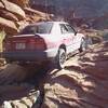
The road to the river. https://gypsybytrade.wordpress.com/2013/10/26/lockhart-basin-road-utah/
Nov 28, 2020 near Moab, UT
loading

Weather


Current Trail Conditions

Unknown
Add Your Check-In

Check-Ins

none
Welcome

Join the Community

Create your FREE account today!
Already have an account? Login to close this notice.

Get Started