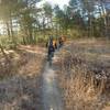
“A mostly paved rail trail useful as a connector. ”
1.8
Miles2.9
KMDoubletrack

 Preserve Clockwise Tour
11.6 mi 18.6 km • 1,100' Up 335.2 m Up • 1,104' Down 336.48 m Down


 Westbro…, CT
 Pachaug State Forest Loop
13.8 mi 22.3 km • 1,142' Up 348.13 m Up • 1,159' Down 353.14 m Down


 Jewett…, CT
 Mooween State Park
11.4 mi 18.4 km • 787' Up 239.84 m Up • 790' Down 240.74 m Down


 Colchester, CT
 Northwest Woods Classic Loop
10.9 mi 17.5 km • 521' Up 158.73 m Up • 521' Down 158.95 m Down


 Sag Harbor, NY
 Airline - Salmon River Singletrack
6.9 mi 11.0 km • 804' Up 245.19 m Up • 804' Down 245.14 m Down


 East Ha…, CT
 Big River Park & Ride - Carr Pond Loop
10.0 mi 16.1 km • 579' Up 176.62 m Up • 580' Down 176.74 m Down


 West Wa…, RI


0 Comments