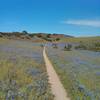
“A challenging climb that's a lot more fun to ride down hill. ”
1.1
Miles1.8
KMSingletrack

Local Club: Monterey Off Road Cycling Association
Land Manager: BLM California - Hollister Field Office
 Inter-Garrison Rd to Kyle's Bench loop.
8.7 mi 14.0 km • 468' Up 142.59 m Up • 486' Down 148.13 m Down


 Marina, CA
 2020 Sea Otter Cross Country - Category 1
29.4 mi 47.4 km • 3,419' Up 1042.14 m Up • 3,412' Down 1039.86 m Down


 Del Rey…, CA
 Road Runner to Razorback
5.2 mi 8.4 km • 702' Up 213.88 m Up • 702' Down 214.09 m Down


 Ridgemark, CA
 Best of Nisene
18.6 mi 30.0 km • 1,951' Up 594.76 m Up • 1,945' Down 592.72 m Down


 Seacliff, CA
 Circle Loop
18.5 mi 29.8 km • 1,259' Up 383.63 m Up • 1,269' Down 386.67 m Down


 Santa Cruz, CA
 Best of Wilder Ranch
16.6 mi 26.7 km • 1,371' Up 417.87 m Up • 1,361' Down 414.73 m Down


 Santa Cruz, CA


0 Comments