
 Continue with onX Maps
 Continue with Facebook


 Intermediate

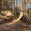
“Decent climbs and speedy descents with scenic views of the Catawba River. ”


2.5
Miles4.1
KMSingletrack
 Intermediate
Local Club: Tarheel Trailblazers
Apr 10, 2024: Purser Hulsey Dirt Day 4/13/24
Jan 8, 2024: 2024 Beatty workday program.
Nov 15, 2023: Back Yard Trail social Ride and Stump Jumper Raffle!!
Land Manager: Mecklenburg County - Park and Recreation
 WWC East/North/South
16.6 mi 26.7 km • 1,096' Up 334.15 m Up • 1,078' Down 328.55 m Down

 Poston Park
7.1 mi 11.4 km • 475' Up 144.76 m Up • 474' Down 144.6 m Down
Renaissance Park
4.0 mi 6.5 km • 303' Up 92.37 m Up • 318' Down 96.78 m Down
 Harrisburg Municipal Park
3.0 mi 4.9 km • 224' Up 68.31 m Up • 232' Down 70.73 m Down
 McAlpine Creek and Campbell Creek Greenway
10.1 mi 16.3 km • 120' Up 36.49 m Up • 120' Down 36.48 m Down
Matthews, NC
Ballantyne District Park
2.8 mi 4.5 km • 138' Up 42.18 m Up • 140' Down 42.67 m Down


 All Clear


0 Comments