
 Continue with onX Maps
 Continue with Facebook


 Intermediate

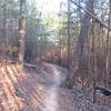
“A pleasant ride through the trees, rhododendron, and mountain laurel. ”


2.3
Miles3.8
KMSingletrack
 Intermediate
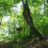
Local Club: SORBA - Chattanooga
Land Manager: GA Department Natural Resources
 Price Branch Trail System
12.9 mi 20.7 km • 959' Up 292.38 m Up • 957' Down 291.79 m Down

 Battlefield Gravel Sixer
6.6 mi 10.6 km • 481' Up 146.5 m Up • 481' Down 146.61 m Down

 High Voltage/Live Wire Shortest Loop
13.3 mi 21.4 km • 1,796' Up 547.55 m Up • 1,795' Down 547.06 m Down
White Oak Mountain Loop
4.7 mi 7.5 km • 360' Up 109.85 m Up • 361' Down 110.13 m Down
 Snake 50 (Dry Creek Segment)
18.9 mi 30.5 km • 2,595' Up 791.05 m Up • 2,501' Down 762.33 m Down
Trion, GA
Johns Mountain
8.7 mi 14.1 km • 1,346' Up 410.15 m Up • 1,347' Down 410.55 m Down


2 Comments