
 Continue with onX Maps
 Continue with Facebook


 Difficult

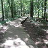
“A technical yet scenic trail with plenty of flow. ”


1.9
Miles3.1
KMSingletrack
 Difficult
Local Club: SORBA - Huntsville
Land Manager: Land Trust of North AL
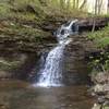
 Blevins Gap Scenic Ride
4.0 mi 6.5 km • 450' Up 137.26 m Up • 449' Down 136.79 m Down


 Hays Nature Preserve
4.0 mi 6.5 km • 33' Up 9.97 m Up • 33' Down 9.99 m Down
 Green Mountain Preserve
2.4 mi 3.8 km • 178' Up 54.18 m Up • 178' Down 54.28 m Down
Monte Sano State Park - Family Bike Trail
4.5 mi 7.2 km • 152' Up 46.39 m Up • 152' Down 46.42 m Down
Huntsville, AL
Monte Sano Plateau Loop
7.0 mi 11.3 km • 249' Up 75.9 m Up • 249' Down 75.99 m Down
Huntsville, AL
 Tour de Lake Guntersville State Park
9.8 mi 15.7 km • 574' Up 174.89 m Up • 576' Down 175.69 m Down


0 Comments