
 Continue with onX Maps
 Continue with Facebook


 Easy
Easy


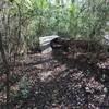
“A scenic greenway that follows the Campbell Creek before turning into the McAlpine Creek Greenway at the river junction. ”


2.1
Miles3.5
KMPaved Path


0 Comments