
 Continue with onX Maps
 Continue with Facebook


 Intermediate

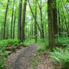
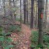
“Southwest side of the lake, parallel to Green Bridge Road. Easy surface with steeper grades. ”


1.7
Miles2.7
KMSingletrack
 Intermediate
Local Club: LHORBA - Laurel Highlands On & Off Road Bicycling Association
Land Manager: Cambria Somerset Authority (CSA)
 Que Trail - Full Loop
16.1 mi 26.0 km • 1,129' Up 344.01 m Up • 1,129' Down 344.16 m Down

 Jerome, PA
 Best of Laurel (Advanced)
20.4 mi 32.9 km • 1,128' Up 343.7 m Up • 1,126' Down 343.33 m Down
Boswell, PA
 Circle of Jones Mill Run Valley
14.7 mi 23.7 km • 1,474' Up 449.28 m Up • 1,476' Down 449.87 m Down
Jones Mills to Laurel Highlands
44.4 mi 71.4 km • 2,986' Up 910 m Up • 2,987' Down 910.44 m Down
LHORBA BKSP Intermediate: "10 Mile Downhill"
8.8 mi 14.1 km • 190' Up 57.84 m Up • 1,643' Down 500.91 m Down
Ohiopyle Shuttle Ride - Summit to Town
11.6 mi 18.7 km • 708' Up 215.86 m Up • 2,245' Down 684.41 m Down


 Minor Issues


0 Comments