Dogs Unknown

Need to Know
At the entry gate of Black Canyon Trail, it states No e-bikes due to BLM land.
If you want to dry camp (boondock), just west of AZ Game & Fish HQ is an unobtrusive gate. This is not locked and leads up along a powerline forming part of Maricopa Trail. Park between the road and the Ben Avery Shooting Facility fence. Given this is the largest range in the US, it is not a particularly quiet area but not as bad as you might think if you stay well south of the firing line. West of the road is Arizona State Land Department (ASLD) and is posted.
Description
On Carefree Highway, the Bob Bentley Trailhead is the southern end of the trail. This has not been developed; it's just a gate in the fence.
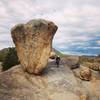
The trail heads north through Biscuit Flats.
Maricopa Trail: Anthem to Lake Pleasant exits to the east.
At the New River, the trail drops down a ramp cut into the bank. A jumble of cobbles follows as you cross the normally-dry riverbed. The trail continues north as singletrack and sections of old road.
All the first section above is flat and a good bit is two-track. North of Emery Henderson is mostly singletrack and it gets a little rougher.
The Emery Henderson Trailhead is on the west side of North New River Road. This is a large day-use only facility, with a gate and on-site host, vault toilets, and water may be available at the host station. Equestrian use is extensive. If you want to boondock in this area, there is a pipeline road 0.3 miles to the north.
Heading north, after about 0.75 miles the widetrack turns into stony singletrack crossing arroyos. Rising into and around low ridges, the trail becomes chunkier with embedded rocks in the trail tread.
The next access point is West Gasline Rd, west of the New River exit on I-17. There is a good flat boondocking spot before the road gets rougher and drops down to the trail.
The next section north is
BCT: New River to Table Mesa Trailhead.
Contacts
Shared By:
John Geronimo
with improvements
by Rad Paul
and 1 other

 Continue with onX Maps
 Continue with Facebook


 Intermediate


0 Comments