MTB Project Logo

A long loop covering the Reach 11 Recreation Area


Your Rating: Rating Rating Rating Rating Rating      Clear Rating
Your Difficulty:
Your Favorites: Add To-Do · Your List
Zoom in to see details
Map Key

18.1

Miles

29.2

KM

0%

Singletrack

1,557' 475 m

High

1,520' 463 m

Low

168' 51 m

Up

167' 51 m

Down

0%

Avg Grade (0°)

3%

Max Grade (2°)

Dogs Leashed

E-Bikes Unknown

Family Friendly Wide easy smooth trail.

Overview

This loop encompasses multiple trails in the Reach 11 Recreation Area. The trails are wide, smooth, and level. A great place for a family bike ride, or a large group ride.

Need to Know

Trailhead parking is at Cave Creek about 1/2 mile north of Deer Valley. Also, parking is available on both sides of Tatum Blvd.

Description

Reach 11 is best known for its sports field complex, but is also home to a number of trails along the north side of the CAP Canal. It is a City of Phoenix park.

The route starts at the underused trailhead on Cave Creek road, about 1 1/2 miles north of the Loop 101 freeway. The trail starts south, passing through a tunnel at Deer Valley Road. The trail then follows through the park just below the bank of the CAP Canal.

After crossing under the 101 Freeway and then the 51 Freeway, the route eventually comes out at a parking area off of of Tatum Blvd. The route crosses Tatum just north of the parking area. There is no tunnel or even a crosswalk here, so exercise care.

After crossing Tatum, the route keeps to the right following near the CAP until coming to an underpass to cross 56th St. Then keeping to the right again, the trail follows the canal dike to Scottsdale Rd, the eastern boundary of the park.

From Scottsdale Rd, the route returns by keeping to the north side of the park, crossing 56th St and Tatum at the same points as before. Past Tatum, part of the route is on a paved road past the Horse Lovers Arena. Once returning to dirt, the trail bends around to complete the loop just short of the AZ-51 crossing. From here the route returns the way it came back to the trailhead.

History & Background

The Term "Reach 11" refers to a segment of the CAP Canal, carrying water from the Colorado River to parts of Arizona.

Contacts

Shared By:

Tom Riddle

Trail Ratings

  3.3 from 3 votes

#1

in Scottsdale

#3572

Overall
  3.3 from 3 votes
5 Star
0%
4 Star
33%
3 Star
67%
2 Star
0%
1 Star
0%
Recommended Route Rankings

#1

in Scottsdale

#134

in Arizona

#3,572

Overall
24 Views Last Month
24 Since Nov 22, 2022
Easy Easy

100%
0%
0%
0%
0%
0%

Photos

Reach 11 Trail passing under the AZ-51.
Nov 22, 2022 near Paradis…, AZ
View from a trail in Reach 11
Nov 22, 2022 near Paradis…, AZ
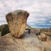
Typical Reach 11 scenery
Nov 22, 2022 near Paradis…, AZ
View of the Reach 11 Trail system
Nov 22, 2022 near Paradis…, AZ

0 Comments

Weather


Current Trail Conditions

Unknown
Add Your Check-In

Check-Ins

Jan 26, 2023
J D
Very easy route. Don't make too much noise in or ride through the pond area. The pond people don't like it. Easy to get sidetracked. 17.4mi — 1h 20m
Welcome

Join the Community

Create your FREE account today!
Already have an account? Login to close this notice.

Get Started