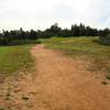
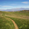
“This is an old power line service road that looks straight on paper, but has some punchy climbs and sandy spots. ”
0.8
Miles1.3
KMDoubletrack

Land Manager: Riverside County Parks
 Caroline Park
1.4 mi 2.2 km • 189' Up 57.65 m Up • 189' Down 57.6 m Down


 Redlands, CA
 Southridge XC Course
5.8 mi 9.3 km • 710' Up 216.56 m Up • 708' Down 215.71 m Down


 Glen Avon, CA
 El Dorado Ranch
7.2 mi 11.6 km • 815' Up 248.46 m Up • 813' Down 247.88 m Down


 Yucaipa, CA
 CHSP East
13.3 mi 21.4 km • 1,693' Up 515.89 m Up • 1,692' Down 515.83 m Down


 Los Ser…, CA
 Tour of the Santa Anas (91 to 74)
55.8 mi 89.9 km • 11,350' Up 3459.41 m Up • 11,052' Down 3368.57 m Down


 Corona, CA
 Rim Nordic XC
8.7 mi 13.9 km • 1,034' Up 315.09 m Up • 1,043' Down 317.84 m Down


 Running…, CA


0 Comments