MTB Project Logo

A city-to-sea gravel grind.


Your Rating: Rating Rating Rating Rating Rating      Clear Rating
Your Difficulty:
Your Favorites: Add To-Do · Your List
Zoom in to see details
Map Key

6.5

Miles

10.4

KM

Doubletrack

40' 12 m

High

11' 3 m

Low

16' 5 m

Up

46' 14 m

Down

0%

Avg Grade (0°)

2%

Max Grade (1°)

Dogs Leashed

E-Bikes Unknown

Description

A flat gravel grind from the Bridge Street parking lot to the sea. Bobcats, birds, and otters can be seen along the river as well as some homeless camps as you pass through town. Riding past the sewage treatment plant can be a stanky but brief affair (pedal harder!) and the view at the end is well worth it. Look for the large turnout at the end and bring a sandwich and relax!

Contacts

Land Manager: City of Watsonville

Shared By:

Salty McSaltertin

Trail Ratings

  2.9 from 8 votes

#1

in Watsonville

#24000

Overall
  2.9 from 8 votes
5 Star
0%
4 Star
38%
3 Star
38%
2 Star
0%
1 Star
25%
Trail Rankings

#1

in Watsonville

#2,032

in California

#24,000

Overall
29 Views Last Month
3,176 Since Aug 26, 2017
Easy Easy

100%
0%
0%
0%
0%
0%

Photos

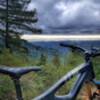
River outlook at Clearwater Park.
Apr 24, 2018 near Watsonv…, CA
RC Aircraft field on Levee Trail
Apr 24, 2018 near Las Lomas, CA
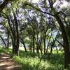
Nature trails in Clearwater park on Levee Trail.
Apr 24, 2018 near Watsonv…, CA
End of trail lookout. Can see Monterey on a clear day. Otters & seals sometimes.
Apr 17, 2018 near Las Lomas, CA
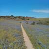
Levee Trail
Apr 24, 2018 near Las Lomas, CA
Lots of this
Apr 24, 2018 near Las Lomas, CA

0 Comments

Weather


Current Trail Conditions

Unknown
Add Your Check-In

Check-Ins

Oct 23, 2022
Steve Degner
Make sure the temp is nice because the ride is, let's say not spectacular. It's good to be outside. A few homeless, and the end is dead a dead end.
Nov 17, 2017
Andrew Chelone
11.1mi
Welcome

Join the Community

Create your FREE account today!
Already have an account? Login to close this notice.

Get Started