
 Continue with onX Maps
 Continue with Facebook


 Intermediate/Difficult

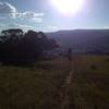
“An excellent descent option coming down from the Desolation Basin. ”


0.5
Miles0.8
KMSingletrack
 Intermediate/Difficult
Local Club: Paonia Singletrack Society (PSS)
Land Manager: BLM Colorado - Uncompahgre Field Office
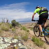
 Jumbo Ridge Loop
8.1 mi 13.1 km • 1,510' Up 460.22 m Up • 1,510' Down 460.12 m Down

 Sidewinder Trail
18.6 mi 29.9 km • 2,864' Up 872.99 m Up • 2,048' Down 624.14 m Down
Orchard…, CO
Pearl Pass to Schofield Pass Bikepack
124.0 mi 199.6 km • 9,731' Up 2965.99 m Up • 9,732' Down 2966.36 m Down
Raggeds Shuttle
20.2 mi 32.5 km • 2,445' Up 745.3 m Up • 4,439' Down 1352.88 m Down
 Old Grand Mesa Downhill Shuttle Run
14.5 mi 23.3 km • 75' Up 22.72 m Up • 3,554' Down 1083.12 m Down
Eagle Spikes Enduro Loop
7.1 mi 11.4 km • 1,438' Up 438.3 m Up • 1,458' Down 444.42 m Down
Olathe, CO


0 Comments