
 Continue with onX Maps
 Sign in with Facebook


 Intermediate

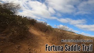
“A fun doubletrack downhill or a difficult climb. ”


1.5
Miles2.4
KMDoubletrack
 Intermediate
Local Club: San Diego Mountain Biking Association (SDMBA)
Land Manager: City of San Diego - Parks & Recreation
 Parking lot to E-Ticket and Back
4.6 mi 7.5 km • 530' Up 161.56 m Up • 559' Down 170.44 m Down

 Santee, CA
 Cowles Mtn
5.4 mi 8.6 km • 1,211' Up 369.03 m Up • 1,224' Down 373.02 m Down
 San Clemente/Rose Canyons
15.9 mi 25.5 km • 628' Up 191.45 m Up • 627' Down 191.26 m Down
Penasquitos Tour
10.8 mi 17.5 km • 825' Up 251.36 m Up • 816' Down 248.61 m Down
Summit Park to Tiki Hut Loop
6.2 mi 10.0 km • 613' Up 186.95 m Up • 615' Down 187.34 m Down
San Dieguito River Park - Bernardo Bay/ Piedras Pintadas Trail
8.2 mi 13.2 km • 570' Up 173.78 m Up • 567' Down 172.96 m Down


1 Comment