
 Continue with onX Maps
 Continue with Facebook


 Intermediate/Difficult


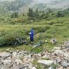
“A fun 4x4 road descent from Hancock Pass to the FS 839 Alpine Tunnel 4x4 Road. ”


1.7
Miles2.7
KMDoubletrack


0 Comments