MTB Project Logo

This ride circles from Big Leaf to Canyon to Creekside for fun workout and great descent!


Your Rating: Rating Rating Rating Rating Rating      Clear Rating
Your Difficulty:
Your Favorites: Add To-Do · Your List
Zoom in to see details
Map Key

4.0

Miles

6.5

KM

40%

Singletrack

610' 186 m

High

236' 72 m

Low

569' 173 m

Up

546' 166 m

Down

5%

Avg Grade (3°)

26%

Max Grade (14°)

Dogs No Dogs

E-Bikes Unknown

Overview

A hidden gem, that works in some steep climbs through meadows and groves of trees to earn a rewarding descent at the end.

Need to Know

There are plenty of hikers, runners, and equestrian riders throughout the entire area, but it's especially important to keep a lookout on Creekside and yield appropriately.

Description

From the parking lot, follow the Big Leaf Connector to the Big Leaf Trail. There's minimal climbing at first as riders parallel Faught Road and enjoy views across the nearby vineyards. Once the trail turns east into the trees it's time to put in some work.

The steep climb is over pretty quickly, but you'll probably feel like taking a break before reaching the intersection with the South Ridge Trail and Ridge Trail in an open meadow. Turn left onto the Ridge Trail and complete another climb to the start of the Canyon Trail.

Canyon Trail is great fun as the switchbacks follow the contours of the hills up and down and all around. There are some nice descents and some more punchy climbs along the way. At the next intersection, turn left to follow the Mark West Creek Trail northwest to reach the Pond Trail.

Follow it north around a tiny pond in a grassy open valley. Just watch for horses as many equestrian riders like to rest their steeds here. At the corner of the pond, cruise onto the Creekside Trail for the highlight of this ride. Creekside is a great section of singletrack that follows an enclosed drainage. It has aspects of a pump track and is an exciting descent! Plus it's mostly shaded, so it makes for a nice cool-down.

At the bottom, Creekside Trail feeds onto the North Ridge Trail which will promptly take riders back to the parking lot.

Contacts

Shared By:

Alex Miller

Trail Ratings

  3.7 from 10 votes

#2595

Overall
  3.7 from 10 votes
5 Star
20%
4 Star
40%
3 Star
30%
2 Star
10%
1 Star
0%
Recommended Route Rankings

#332

in California

#2,595

Overall
20 Views Last Month
2,713 Since Jul 3, 2016
Intermediate/Difficult Intermediate/Difficult

0%
0%
50%
13%
38%
0%

Photos

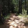
Trees at Shiloh Regional Park.
Apr 6, 2017 near Larkfie…, CA
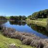
The view at S. Ridge and Canyon. The overlook is just to the right outside the picture.
Jul 3, 2016 near Larkfie…, CA

0 Comments

Weather


Current Trail Conditions

All Clear 31 days ago
Add Your Check-In

Check-Ins

Nov 12, 2023
Timothy Coburn
Jun 20, 2020
Dave Beveridge
Aug 7, 2019
Adam Kuzmicki
Jul 7, 2019
Adam Kuzmicki
Nov 28, 2018
James Fotherby
Jun 9, 2018
Coltonpalmer
Welcome

Join the Community

Create your FREE account today!
Already have an account? Login to close this notice.

Get Started