
 Continue with onX Maps
 Continue with Facebook


 Intermediate/Difficult

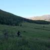
“A rocky climb and fun descent right through the rattlesnake's backyard. ”


1.5
Miles2.4
KMSingletrack
 Intermediate/Difficult
Land Manager: Larimer County, Colorado
 Devil's Backbone Loop
13.2 mi 21.3 km • 1,238' Up 377.42 m Up • 1,234' Down 376.12 m Down

 Bobcat Ridge Tech Tour
11.9 mi 19.2 km • 1,959' Up 597.23 m Up • 1,954' Down 595.56 m Down
Bellvue, CO
West Crosier
10.4 mi 16.8 km • 2,622' Up 799.32 m Up • 2,577' Down 785.49 m Down
 Blue Sky to Indian Summer
11.0 mi 17.7 km • 957' Up 291.55 m Up • 957' Down 291.77 m Down
Laporte, CO
Horsetooth Mountain Park Sampler Loop
13.1 mi 21.1 km • 2,093' Up 637.9 m Up • 2,085' Down 635.51 m Down
Sawmill Nomad Loop
5.0 mi 8.0 km • 990' Up 301.76 m Up • 989' Down 301.46 m Down
Bellvue, CO


1 Comment