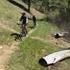
“Lakeside views with many punctuated climbs and descents. ”
7.0
Miles11.3
KMSingletrack

Local Club: Southwest Idaho Mountain Bike Association
Land Manager: USFS - Boise National Forest Office
 Peace Creek Loop
35.1 mi 56.4 km • 5,065' Up 1543.82 m Up • 5,052' Down 1539.94 m Down


 Cascade, ID
 Rocket Trail Loop
2.4 mi 3.8 km • 385' Up 117.22 m Up • 383' Down 116.65 m Down


 Cascade, ID
 Airline Loop
22.1 mi 35.6 km • 3,251' Up 990.84 m Up • 3,246' Down 989.27 m Down


 Idaho City, ID
 Danskin Loop
20.3 mi 32.7 km • 3,828' Up 1166.88 m Up • 3,843' Down 1171.42 m Down


 Idaho City, ID
 Graham-Horse Heaven Loop
54.6 mi 87.9 km • 7,240' Up 2206.72 m Up • 7,238' Down 2206.22 m Down


 Idaho City, ID
 Schoolhouse Gulch Loop
1.9 mi 3.1 km • 257' Up 78.3 m Up • 256' Down 78.1 m Down


 Idaho City, ID


0 Comments