
 Continue with onX Maps
 Continue with Facebook


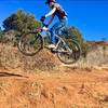
 Intermediate/Difficult

“A twisting climb leading to a scenic overlook and a fun descent. ”


1.5
Miles2.4
KMSingletrack
 Intermediate/Difficult
Local Club: Medicine Wheel Trail Advocates
Feb 26, 2024: Use YOUR voice to direct the future of recreation in Colorado: SCORP ’24
Feb 1, 2024: The Trail That Dare Not Speak its Name
Jan 9, 2024: What is going on in North Cheyenne Cañon?
Land Manager: CO Parks & Wildlife Office - Cheyenne Mnt State Park -
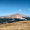
 Vuelta a la Sierra del Almagre (Almagre Mountain Tour)
16.1 mi 25.9 km • 3,330' Up 1015.07 m Up • 3,329' Down 1014.67 m Down
 Pipeline Descent
9.8 mi 15.7 km • 45' Up 13.57 m Up • 3,144' Down 958.14 m Down
 Manitou…, CO
 D-Loop #1.2
14.5 mi 23.4 km • 1,844' Up 562.2 m Up • 1,838' Down 560.21 m Down
Manitou…, CO
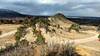
 Roundup Trail Loop at Red Rock Canyon Open Space
3.5 mi 5.7 km • 432' Up 131.55 m Up • 439' Down 133.83 m Down
LPC After Work Ride
5.3 mi 8.5 km • 686' Up 209.09 m Up • 686' Down 209.23 m Down
Ring the Peak 2019
66.8 mi 107.5 km • 10,373' Up 3161.56 m Up • 10,373' Down 3161.84 m Down
Manitou…, CO


 All Clear


1 Comment