
 Continue with onX Maps
 Continue with Facebook


 Difficult

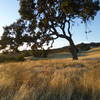
“Fire road with steep ups and downs above Castle Rock Regional Recreation Area. ”


1.8
Miles2.9
KMDoubletrack
 Difficult
Local Club: Bicycle Trails Council of the East Bay
Land Manager: City of Walnut Creek, CA - Open Space
 Paraiso Trail Loop
3.4 mi 5.5 km • 676' Up 205.97 m Up • 682' Down 207.84 m Down
 Old Borges Ranch Double Loop
6.5 mi 10.4 km • 756' Up 230.58 m Up • 752' Down 229.29 m Down
 Dark Side of the Briones (auto free)
18.9 mi 30.4 km • 2,243' Up 683.54 m Up • 2,519' Down 767.94 m Down
Briones Loop-de-Loop (Auto Free)
20.3 mi 32.7 km • 2,592' Up 789.95 m Up • 2,857' Down 870.95 m Down
 Around Round Valley
7.6 mi 12.2 km • 474' Up 144.58 m Up • 474' Down 144.38 m Down
Big Trees Loop
3.4 mi 5.4 km • 390' Up 118.83 m Up • 390' Down 118.95 m Down
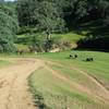
Oakland, CA


1 Comment