*This trail has been re-routed and is depicted here in its current configuration, as of October 2016*
This is a busy trail that provides access to the more exciting back sections of Staunton State Park. It is a short, pleasant ride up a mostly gradual climb through sparsely wooded fields of aspens and conifers. You'll experience multiple beautiful views of the multiple granite cliffs that reside in the park.
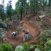
The re-route in 2016 adds about 4/10 of a mile to the original distance and keeps you away from the service road for much longer, instead offering more singletrack fun. A few small obstacles present themselves along the way, but nothing too difficult. It finishes at the same point that the old version of the trail did.
Start from the southernmost parking area in the park, and follow signs for Staunton Ranch Trail behind the restrooms on the east side of the lot. Alternatively, the trail can be accessed from the two parking areas farther north, however, this will leave you with a small climb at the end of your ride if you're riding
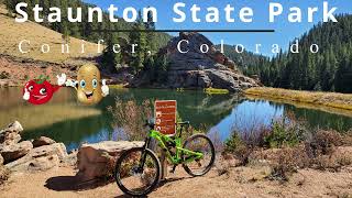
Staunton State Park - Full Clockwise Loop.
A gravel trail leads north following the road for about 0.5 miles, at which point the trail crosses a dirt road next to the 3rd parking area and continues north. This section is pretty crowded with hikers as it is the most accessible area in the park. The trail weaves and heads northwest, providing great views of Lion's Head, a 9,450' granite outcrop that defines the rock formations that can be seen throughout the ride.
At about 2.2 miles enjoy a brief moment of downhill and cross over Black Mountain Creek via a small bridge. Stay on Staunton Ranch Trail as it passes Old Mill and Scout Line Trails on either side (the first of a few hiker only trail intersections). From here, the re-route keeps you on more singletrack that winds it's way through forest while climbing some moderate grade at times. Continue another 3/4 mile northwest past the climbing access trails. It will dump you out onto the 4X4 trail where you'll have the last little climb up to the 4-way intersection of
Marmot Passage Trail,
Bugling Elk Trail,
Border Line Trail, and Staunton Ranch Trail.

 Continue with onX Maps
 Continue with Facebook


 Easy/Intermediate


 Bad / Closed


2 Comments