
 Continue with onX Maps
 Continue with Facebook


 Intermediate

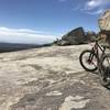
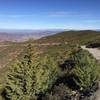
“A challenging fire road that connects Cuyamaca Rancho to Cleveland National Forest. ”


6.8
Miles11.0
KMDoubletrack
 Intermediate
Local Club: San Diego Mountain Biking Association (SDMBA)
Land Manager: California State Parks - Cuyamaca Rancho
 Cuyamaca to Noble Canyon
29.9 mi 48.0 km • 3,485' Up 1062.36 m Up • 3,495' Down 1065.38 m Down

 Descanso, CA
 Redtail Roost Loop Spur Ride
3.5 mi 5.7 km • 502' Up 153.04 m Up • 493' Down 150.26 m Down
Lake Morena Loop
20.8 mi 33.4 km • 2,841' Up 865.95 m Up • 2,841' Down 866.08 m Down
 Barnett Ranch Preserve Ride
4.9 mi 7.9 km • 258' Up 78.54 m Up • 259' Down 78.87 m Down
SDMBA Summit Park and Bonita Golf Course loop
4.4 mi 7.1 km • 324' Up 98.79 m Up • 326' Down 99.38 m Down
La Presa, CA
Baja Divide: Section 1
59.4 mi 95.6 km • 5,220' Up 1590.96 m Up • 3,461' Down 1054.85 m Down
San Diego, CA


0 Comments