
 Continue with onX Maps
 Continue with Facebook


 Intermediate/Difficult


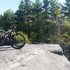
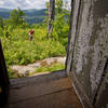
“A burly climb up single and doubletrack for an amazing view. ”


1.3
Miles2.0
KMSingletrack


0 Comments