MTB Project Logo

Northeast side of the lake. Steep sections from the north end to Janidlo Rd. Rocky 0.5 mile section south of Janidlo.


Your Rating: Rating Rating Rating Rating Rating      Clear Rating
Your Difficulty:
Your Favorites: Add To-Do · Your List
Zoom in to see details
Map Key

3.0

Miles

4.8

KM

Singletrack

1,819' 554 m

High

1,543' 470 m

Low

256' 78 m

Up

389' 119 m

Down

4%

Avg Grade (2°)

19%

Max Grade (11°)

Dogs Unknown

E-Bikes Allowed

11/20 UPDATE - With the addition of some Sunday hunting, ALL segments are also CLOSED during posted hunting seasons, generally 11/15 thru 12/31, INCLUDING ALL Sundays. Please respect these closures.

Need to Know

Only Class 1 eBikes permitted on all Quemahoning Trails.
Access:
South end - approx. 500' south of Plank Rd parking lot
North end - north side Plank Rd at back of roadside pulloff just east of Que Creek bridge
Middle - Janidlo and Abex Road crossings

Description

The overall Quemahoning (Que) Trail forms a 16-mile loop around the Quemahoning Reservoir with multiple access points. This is broken into multiple listings, split by road interruptions or access points, to provide shorter, section-specific descriptions. Descriptions are counterclockwise. Trail entrances and road crossings are marked by yellow arrows on brown posts. All segments are non-motorized and non-equestrian.

• This section extends from Plank Road to its intersection with Quemahoning Dam Road.
• This section was made possible through the cooperation of North American Höganäs whose property the northern half of this section occupies.
• Parking is available along Plank Road at the south end of its immediate lake frontage or along Que Dam Road at the other end of this section.
• This section of the trail is the most technical leg of the loop due to a half mile rocky section and steep grades on the northern end.
• This section description begins at the Plank Road crossing, approximately 0.1 mile south of the Plank Road parking.
• The trail climbs gradually from Plank Road for the first 1.5 mile. The surface is generally smooth with varying sidehill exposure, followed by the half mile rocky section through and crossing Janidlo Road
• Trail crosses the power line several times with the third crossing being the steeper downhill with banked switchback of the "Hög Trail" subsection, just below the top of a 250' descent.
• This section continues straight across Abex Road about midway down the descent and drops out at a roadside pull-off on the south side of the Plank Road Bridge.
• The next section begins behind the guiderail, diagonally across the bridge.

Contacts

Shared By:

LHORBA MTB

Trail Ratings

  4.5 from 2 votes

#8764

Overall
  4.5 from 2 votes
5 Star
50%
4 Star
50%
3 Star
0%
2 Star
0%
1 Star
0%
Trail Rankings

#224

in Pennsylvania

#8,764

Overall
3 Views Last Month
685 Since Aug 18, 2019
Intermediate Intermediate

0%
0%
100%
0%
0%
0%

Photos

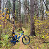
More flowy goodness along the eastern side.
Aug 20, 2019 near Davidsv…, PA
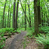
Great benchcutting along the eastern side.
Aug 20, 2019 near Davidsv…, PA

0 Comments

Weather


Current Trail Conditions

Minor Issues 4 days ago
Add Your Check-In

Check-Ins

Sep 29, 2019
Dylan Stiles
7.7miles
Welcome

Join the Community

Create your FREE account today!
Already have an account? Login to close this notice.

Get Started