Use onX Backcountry to explore the terrain in 3D, view recent satellite imagery, and more.
Now available in onX Backcountry Mobile apps!
For more information see this post.
“This is a Mark Twain National Forest trail that formerly served as an old county road.
”
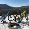
606A begins off Skyline Drive with a small pull-off area to park (two cars max). It follows a doubletrack gravel road through dense forest, which opens up to a glade top. The trail quickly descends down into McAdoo Creek and connects to the Brushy Ridge Trail #606. Expect uneven surfaces and washed-out areas of trail.
Moderately steep. Uneven terrain with small rocks or roots.
Sizable rocks & roots. Steep sections.
Steep. Some technical terrain and limited alternate lines.
Very steep. Technical terrain with no alternate lines.
Difficulty Rating
Average from 1 vote:
Intermediate
Your Rating
Virtual Tour of Brushy Ridge Spur A #606A
We use cookies to improve your browsing experience, to show you
personalized content, and for statistical purposes. By continuing
to navigate our website, you accept our use of cookies. Read our
Privacy Policy to learn more.

 Continue with onX Maps
 Continue with Facebook


 Intermediate


0 Comments