MTB Project Logo

A really nice trail through some beautiful country with nothing but the cows to keep you company.


Your Rating: Rating Rating Rating Rating Rating      Clear Rating
Your Difficulty:
Your Favorites: Add To-Do · Your List
Zoom in to see details
Map Key

9.0

Miles

14.5

KM

50%

Singletrack

5,197' 1,584 m

High

4,569' 1,393 m

Low

1,368' 417 m

Up

1,072' 327 m

Down

5%

Avg Grade (3°)

24%

Max Grade (13°)

Dogs Unknown

E-Bikes Unknown

Overview

A point-to-point ride along a fun section of the much longer Centennial Trail. Start at closed forest access road just off of Sheridan Lake and get ready for a nine-mile ride with climbs and descents throughout. There are some really stunning mountain meadow views in the middle, too!

Description

I would say over half of this route is on abandoned doubletrack, but it hasn't been used in a very, very long time. This trail, like most I have ridden in South Dakota, seems to get little traffic. Thankfully, in July when we rode, someone had recently weed whacked the route so visibility was good and brush scratches were minimum.

The trail is well marked with diamond signage, and Forest Service signage posts. The Centennial Trail symbol is a cow skull with horns. If you take this route as mapped, you'll start at a closed road with a metal gate, just off of Sheridan Lake Road. The trail starts right there and there is room for three maybe four cars.

There is some sustained climbing from the start, but I did not find it terribly strenuous. This area has free range cattle running around. They don't get many visitors and the cattle seemed very confused and scared. Sorry moo's.

As it continues, the trail connects the dots between a few abandoned doubletrack roads. It's important to pay attention to the Forest Service placards because they route you off of one road to another many times. You may also want to keep the MTB Project mobile app handy to avoid having to double back.

The trail mixes from singletrack to doubletrack and when you come to the power lines the trail goes right off of the road you have been riding on. Continue climbing then come to a meadow with some downhill. The trail diverts you off of this road with signage and some downed logs crossing the road.

Eventually, the doubletrack climbs up to a stunning vista of grassland in the middle of this forested area. The next downhill is a treat as the singletrack snakes through the grasslands. The trail turns right, and climbs. Keep an eye peeled for the cairns (stone piles) as the trail was completely gone here.

After this climb riders will reach the best part of the trail. The descent is fast, flowy, and giggle inducing. You cross a stream and then the trail goes up through some areas that are newly planted. After climbing for a while, you come to another downhill section. Pay attention because there are some sharp 90-degree turns in this section.

Finally you'll end up on a well-used road that makes for a good exit. We went to YMCA Road and then rode out to the highway.

Contacts

Shared By:

Phil H

Trail Ratings

  3.5 from 2 votes

#1

in Custer

#3455

Overall
  3.5 from 2 votes
5 Star
0%
4 Star
50%
3 Star
50%
2 Star
0%
1 Star
0%
Recommended Route Rankings

#1

in Custer

#12

in South Dakota

#3,455

Overall
6 Views Last Month
1,811 Since Jul 8, 2017
Intermediate Intermediate

0%
0%
100%
0%
0%
0%

Photos

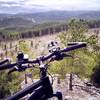
Climbing up an alpine meadow.
Jul 8, 2017 near Colonia…, SD

0 Comments

Weather


Current Trail Conditions

Unknown
Add Your Check-In

Check-Ins

none
Welcome

Join the Community

Create your FREE account today!
Already have an account? Login to close this notice.

Get Started