MTB Project Logo

Backcountry ride with a mix of gravel/Jeep road climb and a long singletrack descent.


Your Rating: Rating Rating Rating Rating Rating      Clear Rating
Your Difficulty:
Your Favorites: Add To-Do · Your List
Zoom in to see details
Map Key

14.3

Miles

23.0

KM

65%

Singletrack

3,897' 1,188 m

High

1,679' 512 m

Low

2,610' 795 m

Up

2,603' 793 m

Down

7%

Avg Grade (4°)

26%

Max Grade (14°)

Dogs Unknown

E-Bikes Unknown

Use caution during hunting season.

Overview

This is a full loop with a big climb to a big descent on some great backcountry trails.

Description

Begin from the parking area by continuing to climb up the road. After ~3.2 miles there will be an obvious intersection with a fire/Jeep road. Take a left and climb up the most traveled Jeep road. There are large ruts at the start, so you'll know you're on the right path. Continue to climb the Jeep road all the way to the top. It is a Jeep road, but still has enough steep/looser sections to keep you engaged. At the top the grade will mellow, there will be a camping/fire ring to the left and just past this there will be a closed metal gate.

Continue past the metal gate and descend briefly, the doubletrack will gain more and more backcountry flavor from this point. After the brief descent you'll climb again slowly before again beginning to descend slowly. At a slight saddle, the trail will angle right and the blue-blazed Dry Run Trail (FT471) will begin. You'll drop more steeply from here. The first bit is relatively smooth with some interspersed rocky sections and an interesting log 'skinny.' You'll dip into the drainage and cross the creek. From this point the trail becomes rockier and more technical. This continues to the bottom, the trail continues to parallel the creek on the righthand side. You'll come to a hard left turn marked by multiple blue blazes and flagging. This can be easy to miss if you aren't paying attention!

Take the hard left and cross the main creek. Climb a bit and you'll reach a trail intersection. The Dry Run Trail ends here. Take a left to continue on Peter's Ridge Trail (PRT) marked by yellow blazes (the right is also PRT and yellow blazes, but takes you quickly to a parking area). The trail climbs briefly and then enters a long section of 'rolling contour.' There will be another trail intersection, stay right here to follow the yellow blazes (PRT). After a couple miles of the rolling, generally fairly smooth terrain, the trail will begin to drop more quickly and you'll emerge on the road right at the cars.

For dog owners: Especially after a rain there is plenty of water throughout this route. The initial section is on a gravel road that is open to cars, so only recommended for reliable dogs even though traffic is light.

Contacts

Shared By:

Lauren Cantwell

Trail Ratings

  3.7 from 3 votes

#1

in Covington

#3291

Overall
  3.7 from 3 votes
5 Star
33%
4 Star
33%
3 Star
0%
2 Star
33%
1 Star
0%
Recommended Route Rankings

#1

in Covington

#96

in Virginia

#3,291

Overall
10 Views Last Month
2,109 Since Apr 7, 2017
Difficult Difficult

0%
0%
0%
0%
100%
0%

Photos

The trail follows along Dry Run as it makes its way through the national forest.
Apr 7, 2017 near Covington, VA
Paralleling the Dry Run Trail, it turns out it's not so dry...
Apr 7, 2017 near Covington, VA
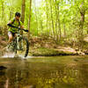
Riding along the creek makes for some beautiful scenery.
Apr 7, 2017 near Covington, VA
This is the second creek crossing on the Dry Fork Trail.
Apr 7, 2017 near Covington, VA
Rock gardens abound on lower Dry Fork Trail.
Apr 7, 2017 near Covington, VA
Old rock benches dot the upper section of the Dry Fork Trail.
Apr 7, 2017 near Covington, VA
loading

Weather


Current Trail Conditions

Unknown
Add Your Check-In

Check-Ins

Sep 5, 2017
Garrett Sessions
18mi — 2h 00m
Welcome

Join the Community

Create your FREE account today!
Already have an account? Login to close this notice.

Get Started