
 Continue with onX Maps
 Continue with Facebook


 Intermediate/Difficult

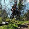
“Up a hill, out and back across a ridge, and down the other side. Good stuff! ”


1.7
Miles2.8
KMSingletrack
 Intermediate/Difficult
Local Club: River Valley Mountain Bike Association
Land Manager: Mountwood Park
 Mountwood Park Grand Tour Loop
22.4 mi 36.0 km • 2,396' Up 730.39 m Up • 2,397' Down 730.48 m Down

 Deerwalk, WV
 Johnson T. Janes Park Loop
1.9 mi 3.0 km • 84' Up 25.62 m Up • 84' Down 25.69 m Down
North Marietta Tour
13.1 mi 21.1 km • 1,534' Up 467.52 m Up • 1,533' Down 467.38 m Down
Marietta, OH
 Ohio View/Jackson Run Lollipop
15.5 mi 25.0 km • 1,963' Up 598.38 m Up • 1,963' Down 598.24 m Down
New Mat…, OH
Wayne National Forest Epic
34.8 mi 55.9 km • 3,227' Up 983.67 m Up • 3,256' Down 992.28 m Down
New Mat…, OH
 Pioneer Trail: Lamping Homestead to Marietta
62.6 mi 100.7 km • 6,473' Up 1973.08 m Up • 6,614' Down 2015.83 m Down
Woodsfield, OH


0 Comments