Dogs Leashed

E-Bikes
Unknown
Overview
This is the is the official track, approved by Naturstyrelsen and is the singletrack for mountain bikers who have mastered basic technique on the bike. The following description is starting at the shooting range, rhusvej 60. There is also a starting point by Sejs Hundeskov, Sejsvej.
Description
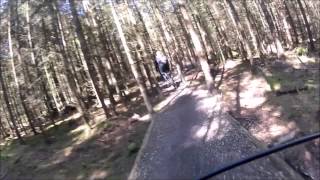
The singletrack goes counterclockwise around, i.e. one starts by turning right.
Description starting from Skydebanevej / rshusvej:
After 0.5 kilometers, you'll get to the "Serpentiner" a real mountain climb with switchbacks. At the top, the track splits into a blue and black session; you'll go left here. After 100 flat meters, you'll cross a gravel road and enjoy the next km through rocky green vegetation known as "Nobilisserne" on a twisted singletrack before you hit the fast, but somewhat technical, descent towards the viaduct.
At the bottom (2 km), you'll cross the red/black tracks and turn left on the gravel road called the "Skovriderens Vej." It continues approximately 500m, before turning left at the little ramp that goes under the name "The trees in love." Look up when you come between the two closely spaced trees just before you hit the shelf, then you'll know why.
The shelf is a nice flow section of approximately 200m in diverse forest. After this, you'll hit the "Wolfhead-climb." The track will split in two several times, and you'll want to stay on the right and follow the blue route.At the top (3.2 km) you'll come to a nice section of the high half-open pine forest.
Here you'll see some optional red loops, but if you keep left every time you'll stay on the blue track - before crossing the gravel road "Wolves Highway" up to the flat section called "Sokr." This section is entirely newly built on a winding singletrack in the pine forest to get it away from the muddy beech forest and forest tracks, where it used to be.
After a short descent and ascent and another descent with a treacherous root in a right turn, get over to the section called "Kberasleren" (4.8 km). This section got its name since during the construction work, we found the jaw of a deer. The track has both humps, roots, and swings that can challenge everyone. If it's too easy, speed up a bit! The first 100 meters is in an open pine forest.
Then, the trail turns to the left and becomes more crude in the closer spruce stands. At the bottom you'll meet "Sejs-junction" - and yes, we know it might be a bit confusing right now, but we are working hard on it. Before long, the flow will hopefully seem logical and easy to follow.
Turn right and follow the trail, first on a technical shelf, later in a more open pine forest, all the way down to the loop's second starting point by Sejsvej and Sejs Hundeskov. For the easiest option, keep left. The only thing that can happen is that you hit the gravel road and must follow it to the bottom.
If you just want to follow the track, then turn left from the gravel road onto a well-engineered climb. If you start from Sejsvej and Sejs Hundeskov (6.3 km) go under the viaduct and keep right on gravel road T-junction. After 50m, starts the landscaped singletrack on your right.
The singletrack is well-made, but in some places it gets very wet - especially in winter. The trail leads you back to the "Sejs Junction" where you continue almost straight ahead on a somewhat technical ascent to a shelf in open pine forest. Soon, you'll fall slightly again and cross a path in the bottom of the gorge before entering a narrow upward shelf that follows the gorge to the top.
At the top (7.9 km), cross the gravel road that quickly descends into a gorge on the other side, right down to the bottom (8.5 km), where you'll turn left on Skydebanevej. Hold on to your brakes - it's fast and there are both flush ends and brake ribs, so hold on, check the road, and keep your weight well back!
At the bottom, you'll turn left and follow the gravel road for 500 meters before turning right into a sweet singletrack, which has almost become a signature piece of the track; it's called "watch out for the trees". There may be speed, but the trees are close together, so beware! After this, you find a small climb, leading to two big berms, which will lead you right back to your starting point.
History & Background
The track was originally constructed back in the early 2000's, and then renovated and extended in 2010 and 2015.
Contacts
Shared By:
Christian Poulsen

 Continue with onX Maps
 Sign in with Facebook


 Intermediate


0 Comments