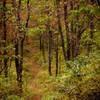
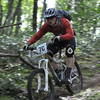
“The primary arterial road used to access many of the trails in Rothrock State Forest. ”
8.4
Miles13.5
KMDoubletrack

Land Manager: DCNR - Rothrock District
 Cooper's Quick Loop
10.7 mi 17.3 km • 1,255' Up 382.43 m Up • 1,264' Down 385.18 m Down


 Belleville, PA
 Greenwood Furnace - 20
19.9 mi 32.1 km • 2,500' Up 761.89 m Up • 2,500' Down 761.98 m Down


 Belleville, PA
 Rothrock TrailMix Short Course
18.7 mi 30.1 km • 2,203' Up 671.51 m Up • 2,204' Down 671.73 m Down


 Boalsburg, PA
 Bald Knob & The Laurels Loop
13.1 mi 21.1 km • 1,891' Up 576.31 m Up • 1,889' Down 575.82 m Down


 Boalsburg, PA
 The Raven MTB Enduro Race, 2013 (public portion)
11.5 mi 18.6 km • 1,040' Up 317.12 m Up • 1,038' Down 316.36 m Down


 Milroy, PA
 Bull Hollow Loop
16.7 mi 26.8 km • 1,628' Up 496.11 m Up • 1,628' Down 496.09 m Down


 Milroy, PA


0 Comments