
 Continue with onX Maps
 Continue with Facebook


 Intermediate/Difficult

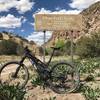
“A rough, rocky ascent along old mining roads that encompasses Fluorite Ridge. ”


5.3
Miles8.5
KMDoubletrack
 Intermediate/Difficult
Land Manager: BLM New Mexico - Las Cruces District Office
 Fluorite Loop
16.6 mi 26.7 km • 1,267' Up 386.05 m Up • 1,266' Down 385.87 m Down


 Massacre Loop
25.6 mi 41.2 km • 1,038' Up 316.45 m Up • 1,034' Down 315.24 m Down
Tres Lomitas
21.1 mi 33.9 km • 933' Up 284.42 m Up • 933' Down 284.36 m Down
Lake Valley to Lower Gila
23.1 mi 37.2 km • 1,385' Up 422.14 m Up • 1,384' Down 421.96 m Down


 All Clear


2 Comments