
 Continue with onX Maps
 Continue with Facebook


 Very Difficult


2.9
Miles4.7
KMSingletrack
 Very Difficult
Local Club: Moab Trail Mix
Land Manager: USFS - Manti-La Sal National Forest Office
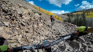
 The Whole Enchilada
34.1 mi 54.9 km • 1,283' Up 390.91 m Up • 7,794' Down 2375.57 m Down

 Moab, UT
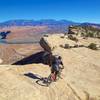
Amasa Back / Cliffhanger
Moab, UT
Amasa Back / Cliffhanger
8.8 mi 14.2 km • 1,327' Up 404.53 m Up • 1,328' Down 404.89 m Down
Moab, UT
 Rocky Jackson
11.0 mi 17.7 km • 1,372' Up 418.31 m Up • 1,383' Down 421.61 m Down
Moab, UT
Poison Spider Loop Route
17.7 mi 28.5 km • 1,975' Up 602.11 m Up • 1,960' Down 597.41 m Down
Moab, UT
 Dead Horse Point Tour
14.4 mi 23.1 km • 644' Up 196.39 m Up • 645' Down 196.64 m Down
Moab, UT
White Rim Trail
100.8 mi 162.2 km • 5,656' Up 1724.01 m Up • 5,636' Down 1717.93 m Down
Moab, UT


1 Comment