
 Continue with onX Maps
 Continue with Facebook


 Intermediate


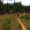
“A rolling Forest Service doubletrack. ”


4.7
Miles7.6
KMDoubletrack
 Intermediate
Land Manager: USFS - Dixie National Forest Office
 Bunker Creek (Right Fork)
14.1 mi 22.7 km • 422' Up 128.52 m Up • 3,086' Down 940.67 m Down
 Parowan, UT
Dark Hollow Shuttle
Parowan, UT
Dark Hollow Shuttle
12.8 mi 20.6 km • 63' Up 19.18 m Up • 4,434' Down 1351.48 m Down
Parowan, UT
 Navajo Lake Loop
13.7 mi 22.0 km • 1,148' Up 349.79 m Up • 1,149' Down 350.23 m Down
 C-Trail
4.4 mi 7.0 km • 13' Up 3.92 m Up • 2,191' Down 667.79 m Down
Cedar City, UT
Iron Trails Sampler
15.4 mi 24.8 km • 1,750' Up 533.47 m Up • 1,750' Down 533.54 m Down
Cedar City, UT
Casto-Cassidy-Rich-Losee Loop
19.7 mi 31.7 km • 1,678' Up 511.46 m Up • 1,676' Down 510.91 m Down


0 Comments