MTB Project Logo

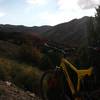
A fun downhill, especially early in the year before the grass gets tall.


Your Rating: Rating Rating Rating Rating Rating      Clear Rating
Your Difficulty:
Your Favorites: Add To-Do · Your List
Zoom in to see details
Map Key

1.7

Miles

2.7

KM

Singletrack

6,459' 1,969 m

High

5,669' 1,728 m

Low

110' 34 m

Up

817' 249 m

Down

10%

Avg Grade (6°)

30%

Max Grade (17°)

Dogs Unknown

E-Bikes Unknown

Description

Across from where the Crystal Springs trail intersects Crystal Summit road there is a short 2-track road heading east to a campsite about 50 yards from the Crystal Summit road. Take this 2-track past the campsite where it turns into singletrack. Follow the singletrack downhill. It soon passes through a small meadow and then angles left up a gentle climb until until reaching a barbed wire fence with a gate. Go through the gate, up a short climb to where it tops out, and then its all downhill to the West Fork trail. There's one creek crossing and a few tight corners, so watch your speed.

This trail can be ridden up from West Fork, but it's a beast of a climb. Consequently, almost all traffic is downhill.

Contacts

Shared By:

TJ Budge

Trail Ratings

  4.0 from 3 votes

#6

in Pocatello

#12474

Overall
  4.0 from 3 votes
5 Star
0%
4 Star
100%
3 Star
0%
2 Star
0%
1 Star
0%
Trail Rankings

#6

in Pocatello

#565

in Idaho

#12,474

Overall
1 Views Last Month
403 Since Jun 30, 2014
Intermediate Intermediate

0%
0%
100%
0%
0%
0%

0 Comments

Weather


Current Trail Conditions

Unknown
Add Your Check-In

Check-Ins

Jul 9, 2018
Adam Kahler
Super fun downhill, but the tall grass makes it a little sketchy. Things hiding in the grass can reach out and get you if you're not careful
Aug 6, 2017
Colin hillburn
Welcome

Join the Community

Create your FREE account today!
Already have an account? Login to close this notice.

Get Started