
 Continue with onX Maps
 Continue with Facebook


 Intermediate

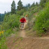
“This short sometimes steep and/or rocky trail is best ridden as part of a larger ride. ”


2.5
Miles4.1
KMSingletrack
 Intermediate
Land Manager: USFS - Okanogan & Wenatchee National Forest Office
 Bear Mountain Figure 8
15.9 mi 25.6 km • 2,667' Up 813.05 m Up • 2,665' Down 812.23 m Down


 Sun Mountain Full Loop
17.7 mi 28.5 km • 2,002' Up 610.33 m Up • 2,003' Down 610.42 m Down
 Big Valley Trail
3.6 mi 5.7 km • 283' Up 86.28 m Up • 294' Down 89.67 m Down
Buck Lake Loop
11.9 mi 19.1 km • 1,486' Up 452.89 m Up • 1,489' Down 453.75 m Down
Rendezvous Basin Loop
11.1 mi 17.8 km • 1,714' Up 522.52 m Up • 1,709' Down 520.83 m Down
Winthrop, WA
 Angels Staircase Loop
22.7 mi 36.6 km • 4,887' Up 1489.7 m Up • 4,897' Down 1492.66 m Down
Twisp, WA


0 Comments