 Race - Oct 19, 2019
Dogs Off-leash

E-Bikes
Unknown

Trails are generally open from May - November. Please do not ride on soft trails during spring runoff as the trails are extremely vulnerable to rutting during that period.
Overview
This ride is 50 miles of pure mtb singletrack through mountain meadows, ridges, and canyons. It features a narrow meandering tread in Ponderosa pine forest at 7400' to 8300' altitude. Pro level riders do the 100 in ~8 hours, fit recreational riders do the 50 in 5-7 hours. There are some short intense climbs, a few fast descents, and miles and miles of fast flowing singletrack under the tall pines with never a dull moment.
Need to Know
This ride will appeal to strong experienced riders looking for a challenge, and can easily be broken into shorter loops for normal recreational riders. There are numerous opportunities for bailing out to the main paved road. There are alternative trailheads at the McGaffey Lake and Strawberry Canyon parking areas. The Hilso Trailhead at mile 7.5 on NM400 has restrooms but no water, and makes an excellent starting point. About half the route is on signed and maintained system trails that are centered around the Hilso Trailhead. More info can be found
here.
Description
This loop ride is described in sections as riders would come upon them. Generally, this route is followed counter-clockwise.
Sawmill Trail- This narrow trail rolls along the side of a ridge, with several ups and downs, and then intersects
Purple Haze Trail just above the Hilso Trailhead, for a total distance of 4 miles. There are some short climbs followed by twisty downs, the high views to the west are superb. The singletrack starts on the left side of Train Canyon Road (FR547) at .42 mi. from the McGaffey Lake Road (FR50) intersection. After a swoop down from Train Canyon Road, the trail climbs over the ridge, then turns right and runs along the foothills. There is a road crossing at 2 mi. and a fence crossing at 3 mi. Turn left at the
Purple Haze Trail intersection to go .5 mi. to Hilso Trailhead.
Purple Haze Trail- Dances across the foothills of a high ridge for 4 mi. from Hilso Trailhead to Milk Ranch Trailhead. It has a viewpoint spur trail on the right at 3 mi. with a challenging climb and spectacular distant views to the north and west. This trail is most challenging when starting from the Milk Ranch Canyon Trailhead.
Milk Ranch Canyon Trail- Starts at NM400 pavement and heads 1.5 mi. west through rolling meadow to Milk Ranch Canyon. After crossing the rippled rock bottom, follow the trail to the right along the south canyon rim, then up a side canyon with a few challenging step ledges and finally a large cave where the trail leaves the drainage and starts to climb up the ridge. After the extended climb finally levels out there is an intersection with
Quasimodo Trail on the right, then a short distance farther a view point spur on the right. The trail starts down soon after and returns to Milk Ranch Canyon Trailhead, down via a lollypop loop down an abandoned road corridor.
Quasimodo Trail- May be the most challenging trail in the McGaffey area, definitely a favorite of the hardmen. The singletrack runs up and down across open Ponderosa hills, drainages, and canyons, sometimes doubling back for another round across the rollers, some 4.5 mi. to
Berma Trail Intersection.
Berma Trail- This was an old two track that was obliterated by the Youth Conservation Corps and then had a singletrack installed in the corridor. It is a fast run down the ridge to Hilso Trailhead, with numerous berm opportunities. 3.4 mi. from Hilso to the top of FR481.
The route for the Zuni Mountain 100 ride is approximately a 50 mile loop; you then reverse the route for the second 50 miles.
History & Background
The area was heavily logged in the early 1900's. The cabins at the end of the pavement are remnants of a logging camp and sawmill operation.
Contacts
Shared By:
Bill Siebersma

 Continue with onX Maps
 Sign in with Facebook


 Intermediate/Difficult

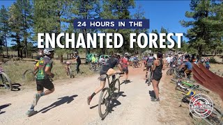
 24 Hours in the Enchanted Forest

 Fort Wi…, NM
 Quartz Crusher Beginner
 Quartz Crusher Advanced


1 Comment