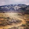
“A never ending descent off the top of Vail's back bowls. ”
8.9
Miles14.3
KMSingletrack

Local Club: Vail Valley Mountain Trails Alliance (Vail Valley Mountain Bike Association)
Land Manager: Vail Resorts
 Vail Big Loop: Climb to Two Elk DH and Back
30.8 mi 49.5 km • 4,080' Up 1243.54 m Up • 4,081' Down 1243.8 m Down


 Vail, CO
 Red Sandstone Rd to Son of Middle Creek
7.8 mi 12.5 km • 1,469' Up 447.85 m Up • 1,469' Down 447.78 m Down


 Vail, CO
 Son of a Buffehr
20.6 mi 33.2 km • 3,139' Up 956.83 m Up • 3,139' Down 956.9 m Down


 Vail, CO
 Meadow Mountain Loop
10.3 mi 16.6 km • 2,088' Up 636.43 m Up • 2,088' Down 636.36 m Down


 Minturn, CO
 Berry Creek Loop
3.9 mi 6.2 km • 890' Up 271.13 m Up • 886' Down 270.1 m Down


 Edwards, CO
 Frisco 20 Loop
20.3 mi 32.6 km • 3,374' Up 1028.54 m Up • 3,375' Down 1028.67 m Down


 Frisco, CO


0 Comments