Dogs Unknown

E-Bikes
Unknown
Description
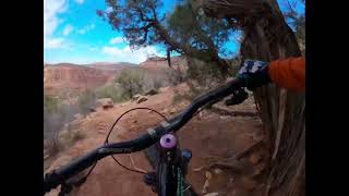
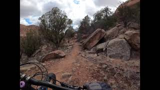
This is great trail access that consists of everything from easy dirt roads, to old mining roads, to technical and flowy singletrack.
With that being said, this is a route that a map and GPS are strongly recommended. Though it starts off pretty easy, expect sections of sand, small loose rocks, and a couple drops that sneak up on you.
I will usually park by the old bridge, where the town of Uravan, CO used to be, then pedal onto Highway 141 toward Naturita, CO. I then will take a right and climb several miles up the EE22 Rd.
Once you have hit the W16 Rd on the right, you have come to the start of the mapped route that is downhill trending. Once I come to the intersection on the singletrack, I stay right to take the Shamrock
Trail back to the vehicle.
There is potential for shuttling this route with 2 cars, staging one at the Uravan bridge, and one at the Intersection of EE22 and W16.
Shared By:
Elijah Sheets

 Continue with onX Maps
 Sign in with Facebook


 Intermediate/Difficult


0 Comments