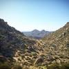
“Trail along the west half of the Reach 11 Recreation Area. ”
4.9
Miles8.0
KMDoubletrack

Land Manager: City of Phoenix - Trails and Desert Preserves
 Reach 11 Long Loop
18.1 mi 29.2 km • 168' Up 51.12 m Up • 167' Down 51.04 m Down


 Cave Creek, AZ
 Sonoran Desert Loop
13.4 mi 21.5 km • 1,112' Up 339.02 m Up • 1,110' Down 338.44 m Down


 Cave Creek, AZ
 Phoenix Sonoran Preserve North/South Loop
13.0 mi 20.9 km • 459' Up 140.02 m Up • 456' Down 139.1 m Down


 Cave Creek, AZ
 The Bell Toll
10.4 mi 16.7 km • 1,981' Up 603.93 m Up • 1,982' Down 603.97 m Down


 Fountai…, AZ
 TT & Windgate - Double Bypass
19.3 mi 31.1 km • 3,303' Up 1006.83 m Up • 3,303' Down 1006.84 m Down


 Fountai…, AZ
 Taliesin Loop
8.4 mi 13.6 km • 560' Up 170.61 m Up • 562' Down 171.34 m Down


 Fountai…, AZ


0 Comments