MTB Project Logo

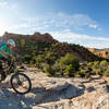
Well-packed trail with short, punchy rock climbs, descents, and exposures.


Your Rating: Rating Rating Rating Rating Rating      Clear Rating
Your Difficulty:
Your Favorites: Add To-Do · Your List
Zoom in to see details
Map Key

6.8

Miles

10.9

KM

Singletrack

5,439' 1,658 m

High

5,139' 1,566 m

Low

570' 174 m

Up

424' 129 m

Down

3%

Avg Grade (2°)

12%

Max Grade (7°)

Dogs Off-leash

E-Bikes Unknown

Features Drops/Jumps · Views

Description

This trail is accessed either from Got Milk? (clockwise) or from an unmarked parking area (counter-clockwise). There are lots of short, punchy rock climbs and descents, with some challenging sections that are unavoidable.

Most of the trail maintains the same level of difficulty with very few 'dead' sections. Rock exposures along a couple sections of the trail provide good views of the area as well as a little more challenge.

Contacts

Shared By:

Branon Rochelle

Trail Ratings

  4.5 from 2 votes

#8796

Overall
  4.5 from 2 votes
5 Star
50%
4 Star
50%
3 Star
0%
2 Star
0%
1 Star
0%
Trail Rankings

#363

in Utah

#8,796

Overall
6 Views Last Month
329 Since Jun 9, 2021
Intermediate/Difficult Intermediate/Difficult

0%
0%
0%
100%
0%
0%

0 Comments

Weather


Current Trail Conditions

Unknown
Add Your Check-In

Check-Ins

May 7, 2022
David Sam
11.3mi — 1h 48m
Welcome

Join the Community

Create your FREE account today!
Already have an account? Login to close this notice.

Get Started