
 Continue with onX Maps
 Continue with Facebook


 Intermediate


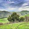
“Outstanding views, with some extremely steep sections. ”


4.1
Miles6.5
KMDoubletrack
 Intermediate
Land Manager: Santa Clara County Parks
 Heron & Edwards Trail
2.5 mi 4.1 km • 305' Up 92.93 m Up • 544' Down 165.91 m Down
 Montgomery Hill Loop
3.0 mi 4.8 km • 427' Up 130.28 m Up • 424' Down 129.24 m Down
Coyote Valley Open Space Preserve
3.9 mi 6.3 km • 592' Up 180.46 m Up • 593' Down 180.72 m Down
Mine Hill Loop
6.1 mi 9.8 km • 1,155' Up 352.04 m Up • 1,152' Down 351.23 m Down
Belgatos-Heinz Loop
7.2 mi 11.6 km • 1,296' Up 395.14 m Up • 1,295' Down 394.7 m Down
 Mission Peak Panorama and YSC Loop
5.1 mi 8.2 km • 1,196' Up 364.68 m Up • 1,194' Down 364.06 m Down


0 Comments