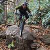
“Remote, singletrack trail with fun downhill section ending at Flat Rock Creek. ”
1.2
Miles1.9
KMSingletrack

Land Manager: USFS - Nantahala National Forest Office
 Pisgah Stage Race - Stage 5
28.5 mi 45.8 km • 2,863' Up 872.78 m Up • 2,780' Down 847.39 m Down


 Brevard, NC
 Pisgah Stage Race - Stage 1
22.2 mi 35.7 km • 3,788' Up 1154.47 m Up • 3,793' Down 1156.05 m Down


 Brevard, NC
 Pisgah Stage Race - Stage 3
31.4 mi 50.5 km • 5,727' Up 1745.44 m Up • 5,728' Down 1745.87 m Down


 Brevard, NC
 Pisgah 111K
72.1 mi 116.0 km • 8,909' Up 2715.32 m Up • 8,903' Down 2713.64 m Down


 Brevard, NC
 Avery Creek to Bennett Gap Loop
15.7 mi 25.2 km • 3,013' Up 918.33 m Up • 3,017' Down 919.45 m Down


 Brevard, NC
 DuPont - Micajah to Wilkie Loop
2.9 mi 4.7 km • 354' Up 107.96 m Up • 355' Down 108.15 m Down


 Brevard, NC


0 Comments