MTB Project Logo

Connector from D Road to Floaty McZebratail.


Your Rating: Rating Rating Rating Rating Rating      Clear Rating
Your Difficulty:
Your Favorites: Add To-Do · Your List
Zoom in to see details
Map Key

0.8

Miles

1.3

KM

Doubletrack

1,824' 556 m

High

1,773' 541 m

Low

57' 17 m

Up

55' 17 m

Down

3%

Avg Grade (1°)

5%

Max Grade (3°)

Dogs Unknown

E-Bikes Unknown

Features Drops/Jumps

Need to Know

As with any multi-use trail, be aware of OHVs, hikers, and cyclists using trails.
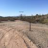
Description

This trail connects the top of D Road (8112 D Road) to Floaty McZebratail. Some loose, larger rocks on route. There is a large wash crossing for which conditions can change rapidly depending on use by OHVs and rain, just before the 0.4 mi. point from start.

The S entrance into the wash is often off-camber, with large, loose rocks on left side of trail. The N exit uphill is a short, steep climb. Best on a fatbike but rideable on a standard mtb or gravel bike with extra caution and expertise.

Contacts

Shared By:

Danny Martin

Trail Ratings

  3.0 from 1 vote

#29

in Ajo

#31337

Overall
  3.0 from 1 vote
5 Star
0%
4 Star
0%
3 Star
100%
2 Star
0%
1 Star
0%
Trail Rankings

#29

in Ajo

#917

in Arizona

#31,337

Overall
1 Views Last Month
10 Since Jan 18, 2021
Intermediate/Difficult Intermediate/Difficult

0%
0%
0%
100%
0%
0%

Photos

This is the top (upslope start) of "Floaty McZebratail" (to left) as viewed at the turn from "D to FMZ Connector" (to right).
Feb 7, 2021 near Ajo, AZ
This is the south (northbound) entrance into a large wash. Off camber and varies based on rain and OHV use.
Feb 24, 2021 near Ajo, AZ

0 Comments

Weather


Current Trail Conditions

Unknown
Add Your Check-In

Check-Ins

none
Welcome

Join the Community

Create your FREE account today!
Already have an account? Login to close this notice.

Get Started