
 Continue with onX Maps
 Sign in with Facebook


 Intermediate

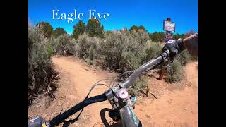
“Fast and flowy (Moab flowy), follows a beautiful rim line with some epic views! ”


2.3
Miles3.7
KMSingletrack
 Intermediate
Local Club: Moab Trail Mix
Land Manager: BLM Utah - Moab Field Office
 Bikepacking: Moab to Boulder Town
294.3 mi 473.6 km • 16,628' Up 5068.07 m Up • 14,007' Down 4269.41 m Down

 The Whole Enchilada
34.1 mi 54.9 km • 1,283' Up 390.91 m Up • 7,794' Down 2375.57 m Down
 Moab, UT
HyMasa/Captain Ahab
Moab, UT
HyMasa/Captain Ahab
9.0 mi 14.5 km • 1,216' Up 370.51 m Up • 1,213' Down 369.69 m Down
Moab, UT
 Poison Spider Mesa
16.0 mi 25.8 km • 1,393' Up 424.71 m Up • 1,393' Down 424.69 m Down
Jug Handle Loop
37.5 mi 60.4 km • 3,247' Up 989.62 m Up • 3,249' Down 990.36 m Down
Moab, UT
Canyon Rims-Lockhart Basin Loop
120.1 mi 193.3 km • 5,342' Up 1628.31 m Up • 5,294' Down 1613.7 m Down


 All Clear


3 Comments