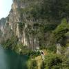
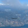
“Get speed and fun on an old military trail. ”
1.6
Miles2.6
KMSingletrack

 Unknown
 Lago Vintage: Bocca di Trat
23.9 mi 38.5 km • 6,084' Up 1854.26 m Up • 6,084' Down 1854.5 m Down


 Riva de…, IT
 Lago Vintage: Altissimo
15.7 mi 25.3 km • 2,594' Up 790.71 m Up • 7,433' Down 2265.7 m Down


 Nago-To…, IT
 Malga San Giovanni via Calvola
16.8 mi 27.0 km • 3,860' Up 1176.57 m Up • 3,865' Down 1178.02 m Down


 Tenno, IT
 Cercenà Loop (Monte Misone)
14.5 mi 23.4 km • 4,381' Up 1335.18 m Up • 4,377' Down 1334.17 m Down


 Fiavè, IT
 Pinzolo Express
15.4 mi 24.8 km • 1,426' Up 434.57 m Up • 5,613' Down 1710.99 m Down


 Carisolo, IT
 Flowers of Monte Baldo
34.5 mi 55.5 km • 6,830' Up 2081.93 m Up • 6,830' Down 2081.92 m Down


 Garda, IT


0 Comments