
 Continue with onX Maps
 Continue with Facebook


 Difficult

 Difficult
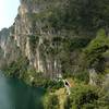
 Malga San Giovanni via Calvola
16.8 mi 27.0 km • 3,860' Up 1176.57 m Up • 3,865' Down 1178.02 m Down
 Monte Velo - Naranch Trail Loop
17.8 mi 28.6 km • 3,947' Up 1203.18 m Up • 3,965' Down 1208.41 m Down
Lago Vintage: Passo Tremalzo via Val Scaglia
31.7 mi 51.0 km • 7,469' Up 2276.48 m Up • 7,479' Down 2279.49 m Down
 Riva de…, IT
 Lago Vintage: Altissimo
15.7 mi 25.3 km • 2,594' Up 790.71 m Up • 7,433' Down 2265.7 m Down
Paradiso Loop - The Old Austrian Military Trail
13.3 mi 21.5 km • 3,137' Up 956.05 m Up • 3,145' Down 958.68 m Down
 Flowers of Monte Baldo
34.5 mi 55.5 km • 6,830' Up 2081.93 m Up • 6,830' Down 2081.92 m Down


0 Comments