Dogs Unknown

E-Bikes
Unknown
Features
Commonly Bikepacked
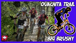
Overview
This segment begins where USFS Road 375 crosses the trail. Begin with some easier terrain and a good warm up climb that will lead to some very fun up and down sections. You'll come to an intersection of sorts after a long fun downhill, after which a long, steep, grueling climb awaits. But once you've finished the trail is almost all downhill from there.
Keep pedaling until you see a great view off to the right and make sure to get a photo. After this, there's plenty of great, tight and technical descent ahead. When you come to the road take a left to get to Big Brushy Campground.
Need to Know
Bring plenty of water and plenty of tubes.
Description
Big Brushy Trail features a lot of amazing cycling into a short distance. Begin at the intersection where USFS Highway 375 crosses the trail. There's a couple different 150 foot entry points, but they all lead to the same spot, so don't worry about taking the wrong one. After the trails merge, you'll be greeted instantly with a short, rocky uphill—it's a qualifier of sorts, though it's probably harder than anything else on the trail, so don't be intimidated if you don't clear it.
After which, enjoy a moderately sloped and smooth uphill section that takes you through some of the beautiful Ouachita Forest landscape. The grey rocks covered in green moss line the trail on both sides and occasionally provide some tricky terrain. After about a 1000 feet, you'll come across a huge boulder on the left. If you want, this is a good place to take some photos or check out the texture and quality of the rock if you're interested in that sorta thing.
Get back on your bike and pedal a bit farther up some easy terrain until you come to your first short downhill segment. Large rocks occasionally jut out into the trail, so be careful not to clip a pedal while passing through. The trail will flatten out for a short bit, then you'll enter into another somewhat longer downhill section in which a small rock garden leads to a widening of the trail. Let off the brakes here and let the hill take you down into a beautifully cut left hand turn which spits you onto a couple of fun optional jumps.
At the bottom, you'll reach an intersection. If you need to, the double wide trail to the left will lead you downhill all the way back to Highway 270. If all is good though, continue straight and begin the toughest section of the trail, which takes you through multiple rock gardens and a very steep climb with tricky features sprinkled throughout. Look to the left at the beginning of the section for a "Shelter" sign and hike up the hill to check out one of the many shelter cabins that were hand-built by the Friends of the Ouachita Trail. They're very cool.
You'll know you've reached the top of the climb when you come across a very difficult rock step up, which seems nearly impossible. After which, enjoy a short flat section of trail with a slight uphill before beginning the second downhill segment. This one is a bit different than the first in that it is straight on but very chunky and somewhat steeper. Watch out for large loose rocks if you don't have big tires.
When the trail flattens out, you'll come across an intersection on the left for the Big Brushy Trail, which leads to the same spot, but isn't maintained as well as the Ouachita Trail, so stay straight and make your way up the last uphill section, which is not so technical but definitely steep in some places. When you get to the top, continue a few hundred feet downwards, but make sure you stop at the overlook on the right, as it is one of the best on the entire Ouachita Trail.
Enjoy a beautiful view and re-hydrate for the last, and longest downhill segment of the trail. Begin on some really fun narrow singletrack with the occasional rocky patch. You'll hit a few short, punchy, rocky climbs and one flat rock garden section. After this though, it's literally all downhill, so be ready to rip! Tight rocky sections eventually give way to an open piney section of fast rolling terrain. The trail will eventually curve left and be ready for a last short section of rocks before reaching the road. Turn left at the road and pedal a quarter mile over a cool bridge to get to the Big Brushy Rec Area.
Contacts
Shared By:
Sam Dudley

 Continue with onX Maps
 Sign in with Facebook


 Difficult

 Blowout Mountain

 Womble Trail - IMBA EPIC
 Mount Ida, AR
 Brush Heap Loop


0 Comments